In 1947, meteorologists in Washington, D.C. repurposed World War II military radar dishes to detect the formation of thunderstorms. Throughout the following decades, that technology was refined into sophisticated Doppler radar, which–by bouncing microwave signals off of storm systems, and interpreting the feedback–could even help predict hurricanes and tornadoes. Since then, new equipment, every improving supercomputers, and precise analytical models have emerged which process a vast array of data, and help forecast natural disasters even sooner before they strike.
Volcanic Eruption
Today, over 800 million people live within 100 kilometers of a volcano. Monitoring can be the key to a timely evacuation; luckily, strategies for reading volcanic activity have advanced significantly over the past century. Volcanologists now employ seismometers to study magma movement, as well as sensors that measure the buildup of gasses and pressure. These instruments can better pinpoint the presence of eruption triggering factors. Novel analysis methods have come about as well, such as reading low-frequency infrasonic waves to identify different types of volcanic activity. Currently, 62 volcanoes are considered high-risk, due to their recent activity, and distance from large population centers.
Earthquakes
Seismologists’ ability to predict earthquakes has been enhanced by the advent of instruments that can decipher sounds produced by the movement of tectonic plates. The Global Seismographic Network–an international system of 150 monitoring centers spread over 80 countries–has installed sensors directly atop fault lines to track seismic shifts in real time. There will always be surprises, but this influx of data has granted scientists a clearer and more comprehensive image of the cycle of tectonic activity that leads to earthquakes. While seismologists can’t yet deduce exactly where or when an earthquake will occur, they can determine the likelihood of an earthquake recurring in a given place; for instance, the U.S. Geological Survey estimates that there is a 63% probability of a large-scale earthquake striking the San Francisco Bay Area over the next 30 years.
Tornadoes
The National Oceanic and Atmospheric Administration gathers data recorded by satellites, weather radar, and reports from locally based volunteers known as storm spotters. This information is placed into algorithmic models to calculate the risk of tornadoes occurring within specific areas. Currently, the national average time between the issuance of a warning and a tornado’s appearance is 16 minutes; atmospheric researchers at the University of Massachusetts, however, have proposed a way to lengthen that timespan. By installing networks of small radar instruments on buildings, UMass scientists hope to capture vital data that aircraft-based storm sensors might overlook, which would further refine the accuracy of tornado predictions.
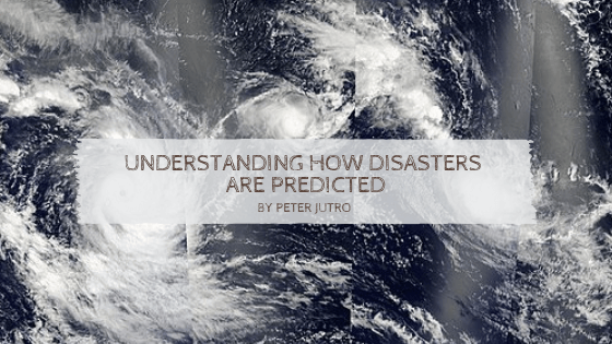
Hurricanes
The Atlantic Hurricane season lasts from June 1 to November 30, during which satellites scan tropical weather systems for hurricane potential. Once a storm is spotted, “hurricane hunter” aircraft are deployed to take readings for further analysis. Using current strategies, meteorologists can accurately predict the coming of a hurricane two to six days ahead of time. Although precise forecasts of hurricane strength and path are still a challenge, innovative strategies–such as dropping a Coyote drone into the center of a storm to relay real-time readings–are allowing meteorologists to better understand the mechanics of hurricane formation, which may in turn help fine-tune predictive capabilities.
Nevertheless …
Despite all of these efforts and advances, loss of life is still heavily influenced by the degree of trust the public places in predictions. Not surprisingly, most people do not follow the evolution of scientific approaches to analysis of potential disasters, so are willing to take greater risks because of memories of instances of instances in the past when forecasts have been incorrect. Continuing attention to developing ever better communication tools and sharing with the public in an understandable fashion, an understanding of scientific progress, could well be significant factors in reducing disaster mortality.